More
- Where our mission meets our passion -
June 15, 2023
HISUI, Earth observation hyperspectral sensor can help countries formulate effective climate policy
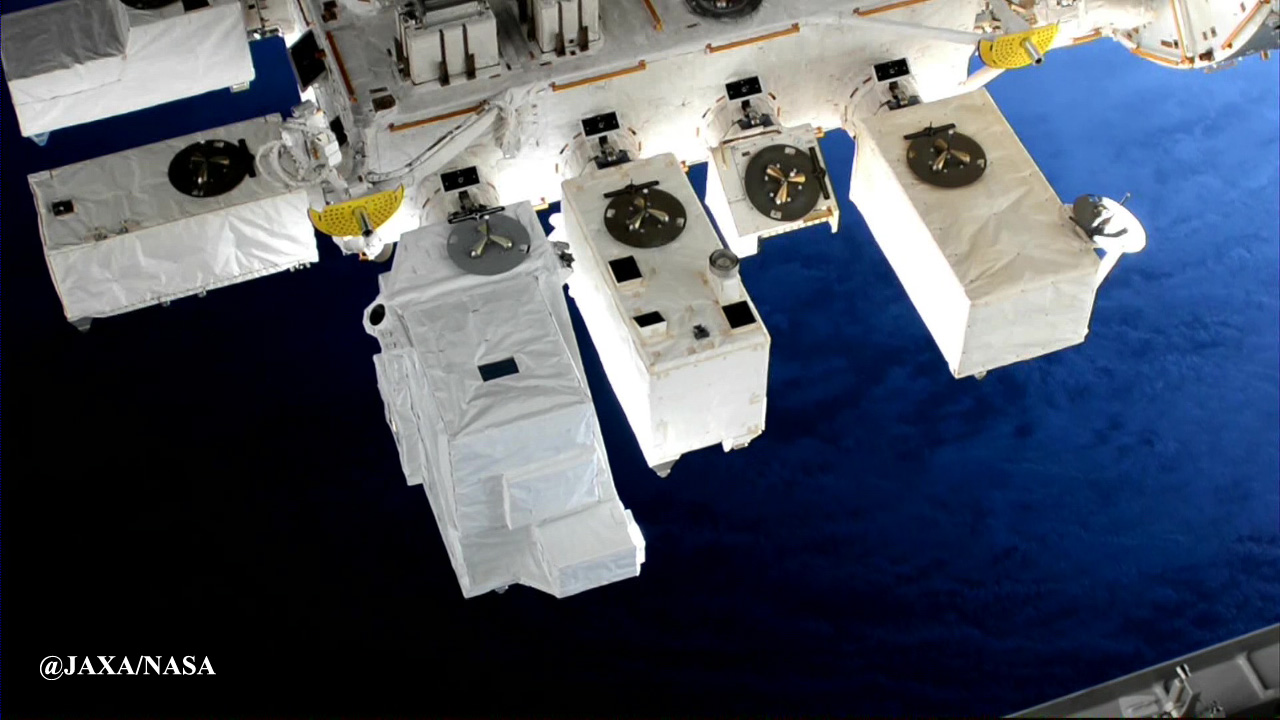
HISUI (the equipment facing down from the left edge) deployed on the International Space Station
The hyperspectral imager HISUI has been attracting attention for its new potential application by the satellite earth observation. Launched in December 2019 as a project of the Ministry of Economy, Trade and Industry (METI), HISUI has been deployed on the International Space Station. From October 2022, METI, in collaboration with the Japan Aerospace Exploration Agency, began providing HISUI data on Tellus, a satellite data platform developed by METI and operated by a private company.
HISUI is an abbreviation for Hyperspectral Imager SUIte. The name also sounds the same as the Japanese word for jade. HISUI identifies in fine detail the electromagnetic waves that reflected from the Earth and gives us the information to understand the properties of the land, sea and atmosphere. It is expected to play a major role in climate policy measures with growing importance for businesses.
Where are the locations of peat, which gives impact to global warming? Precisely determining the distribution by combining terrestrial and satellite data
The Amazon wetlands cover an extensive portion of northeast Peru. One way of learning about the condition of the soil is to walk around the muddy land while taking soil samples here and there with a long stick called a soil auger. Kazuyo Hirose, who heads the Satellite Data Solution Division of Japan Space Systems, has been visiting that region nearly every year since 2016 to carry out such work, as part of a Japan International Cooperation Agency project.
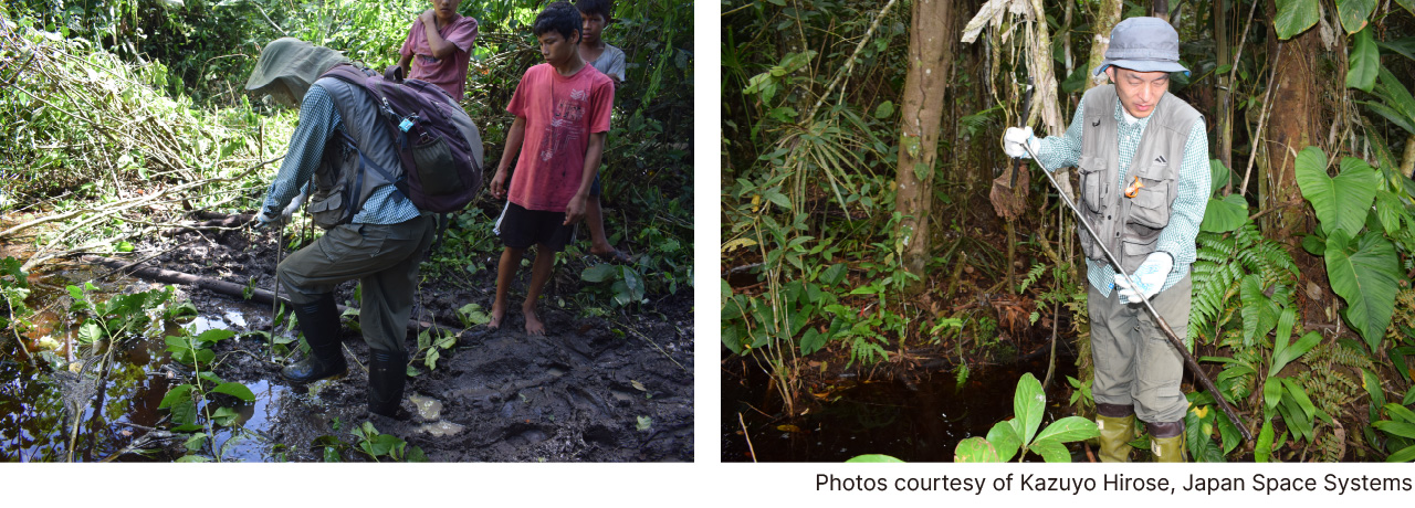
Surveying peat in the Amazon wetlands spreading over northeast Peru is conducted by poking a long stick called a soil auger into the ground and inspecting the mud samples adhering to it.
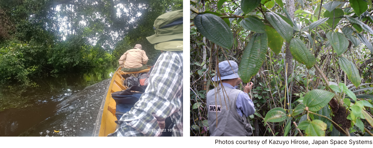
The team surveys by canoe around the Amazon. Peatlands are covered by an indigenous palm species.
Spreading throughout the area is the soil called peat, formed due to incomplete decomposition of dead plants in wetlands. Peatlands are concentrated in tropical Peru, Congo basin and Indonesia, as well as in cold areas such as the Arctic Circle and Siberia. While it is only around 3 percent of the Earth’s surface, the amount of carbon these areas contain is estimated to be 550 gigatons, approximately twice the amount stored in the world’s forests.
When peatlands are lost to fires or indiscriminate development, the carbon is released into the atmosphere as carbon dioxide. Large-scale fires in Southeast Asia in 2015 are estimated to have resulted in the release in around two months the amount of carbon dioxide that surpassed Japan’s annual emissions.
In Peru, especially, even the size and locations of peat have not been accurately identified. It would be difficult to cover all the wetlands on foot. What Dr. Hirose depends on is satellite data.
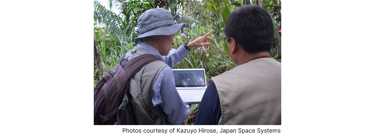
Surveys of Amazon peatlands are being carried out while referring to satellite data.
Various kinds of electromagnetic waves are reflected from the Earth’s surface. The wavelength and its intensity reflected from the surface show different patterns, determined by the surface material and condition. Peru’s peatlands are dominated by a particular species of indigenous palm. Being able to identify this palm from satellite data would make it possible to estimate the extent to which the peat is distributed over the vast area. It is expected that by using HISUI data, the accuracy of the estimates will be exponentially improved.
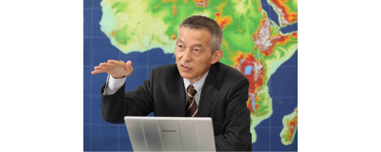
Dr. Kazuyo Hirose of Japan Space Systems, who is using satellite data to survey peat coverage in Peru and in the Congo Basin of Africa
The world’s top-class spectral resolution, able to distinguish even slight differences in materials
Some of important factors determine the capabilities of an optical satellite: the spatial resolution (the minimum distance between objects that can be identified); temporal resolution (the frequency by which the satellite acquires data for a given location); and spectral resolution (the ability to identify fine wavelength intervals - in other words, to distinguish different wavelengths in an electromagnetic wave spectrum).
HISUI has 185 spectral bands in regions from visible near-infrared (VNIR) to short wavelength infrared (SWIR). The spectral resolution is 10 nanometer and 12.5 nanometer in VNIR and SWIR respectively. It boasts the world’s top-class spectral resolution. Dr. Hirose said of HISUI, “We can see things now that had not be seen from satellites before. It provides benefits to a wide range of fields.” Because of high spectral resolution of HISUI, it supports the variety of application fields. And it is expected to provide results in resource exploration such as for oil and metals including rare earths.

In 2022, METI formed a study group consisting of experts and persons related to satellite operators, user companies, and financial institutions.
They began discussions on business use of data obtained from HISUI and other multispectral sensors.
Detecting “greenwashing” to make carbon credits more trustworthy
Another area where it is hoped HISUI will play an active role is in helping to prevent greenwashing.
Greenwashing means the behavior of a corporation that claims to be acting on behalf of the environment but whose claims are not backed up by the actual situation. At the 27th Conference of the Parties to the United Nations Framework Convention on Climate Change, held in Egypt in November 2022, U.N. Secretary-General Antonio Guterres made it clear that “We must have zero tolerance for net-zero greenwashing.”
Public displeasure with companies that do not take seriously their responsibility for climate policy measures is growing stronger year by year. Even though there are companies that have drawn up bold plans for reducing greenhouse gas emissions, carrying out such plans is a costly undertaking. Since, however, emissions themselves cannot be seen with the eye and are difficult to confirm objectively, suspicions that greenwashing is going on cannot be fully dispelled.
With HISUI it may become possible to measure the amounts of greenhouse gases emitted from factory smokestacks or from coal mines, helping to see through token reduction plans.
Where greenwashing is especially a concern is on carbon credit markets, where buying and selling of greenhouse gas emission reduction amounts take place. For companies in businesses where it is difficult to reduce greenhouse gas emissions, carbon credits are seen as a valuable means for contributing to decarbonization. There are entrenched suspicions, however, that carbon credits are being issued for projects in which conservation of forests or peatlands is not properly managed. Creating a system to ensure that money will be delivered to companies or groups sincerely taking on decarbonization is essential to growth of the next-generation society and economy.
Currently, studies on how to improve carbon credit markets are taking place in a task force led by financial institutions, major corporations, non-governmental organizations and other private sector players in the West, China, India and elsewhere. Among the participants from Japan are the Mitsubishi UFJ Financial Group, Mitsui & Co., Mizuho Research & Technologies and INPEX.
Takumi Hashizume, Director of the Industry Research & Creation Division of MUFG Bank, Ltd., observed: “Making credits more trustworthy is urgently needed for the sound growth of carbon credit markets. Data from multispectral sensors like HISUI is expected to contribute toward objectively verifying that sustainability efforts are being undertaken in good faith, and from that standpoint has the potential for generating high added value. In the future, it may play a similar role in sustainable finance (investment and lending in companies working toward realization of the SDGs).”
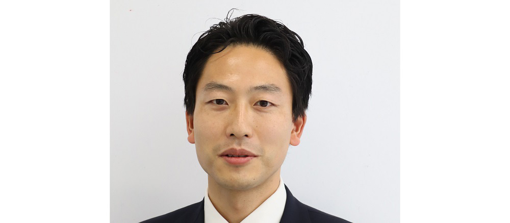
Satellite data has the potential to help ensure the trustworthiness of carbon credit markets” (Takumi Hashizume, MUFG Bank, Ltd.).
What does the future of the satellite business have in store? This is something that will continue to be watched with keen interest.